So You Want to Climb Mt. Hood? A Tutorial
Call me biased ‘cause it’s my home mountain, but I think there is no better place in the lower 48 to jump into mountaineering than good ol Wy’east. More commonly known as Mt Hood, or “Hoody”, Wy’east is the highest peak in Oregon, and one of the most accessible volcanoes of the Cascades all year long. It boasts a short approach, numerous routes, and the classic Cascade snowpack that comes in heavy and heals up quickly! That’s right all you central mountain avalanche gurus. Our snowpack is much wetter and heavier than your fluffy powder, which means long term weaknesses that could cause avalanches tend to get crushed and obliterated by our aptly name, “Cascade Concrete.” If this all sounds like mumbo-jargon to you then stick around! Maybe this article will be just the thing to take you from household hopeful to summit successful.
I am a firm believer in a light pack paired with a heavy weight of knowledge when it comes to the mountains. Our greatest tool is arriving at a challenge well prepared for the tasks that may present themselves.
As such, this guide should offer a fair amount of information for you to bolster your mental toolbox, while hopefully avoiding the extensive babbling and rabbit-hole tangents I may inevitably fall down. My goal is not to provide you with weather models to pour over, or directions for each turn of every route, but rather the broad brushstrokes that will direct your mind towards more in-depth research.
Photo credit: @byronkrempl
The Big Picture
First things first, let’s get to know our playground.
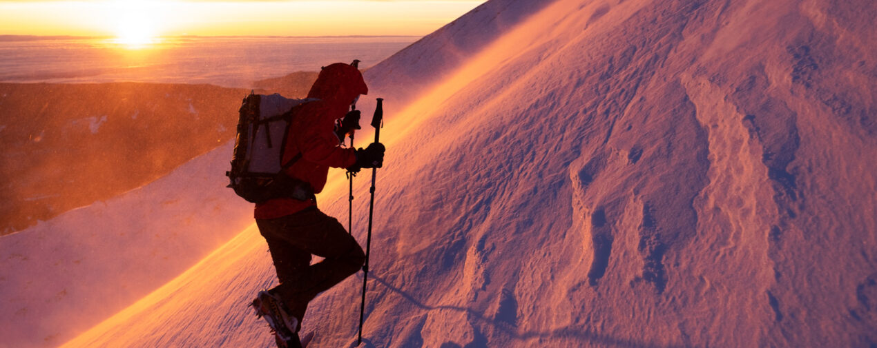
Standing at a meager 11,249’ above sea level, Wy’east may be looked down upon by snobby Colorado hikers, but at least we can say our tallest peak hasn’t seen a Jeep drive to its summit. Rotten volcanic gravel and streaks of broken andesite are capped with the thick Cascade snowpack for about half the year, while the warmer months expose the glaciers scattered across the peak. If you want to start climbing the peak, you really just need to get acquainted with the South side of it. Starting from Timberline Lodge at 6000’, the south side approach sees probably 99% of climbing traffic. The Northern approach represents the next largest percent, and the Northwestern approach may see a handful of mountaineers each spring and summer. There is a good reason for this. Timberline Lodge offers a well plowed road and parking lot that starts climbers closer and higher than any other option. With it’s windswept ridge and a slope that won’t send avalanches across your approach, the Palmer snowfield leaves little danger in its snowpack. Also, it is often far too icy and firm to warrant any need for snowshoes. Ski lift cables and snow plow tracks guide you up the first half of your climb, and navigation to the upper mountain is reduced to one simple direction: up!
*Note: While climbing up Wy’east can be as simple as heading up a staircase, the Southern approach is famous for luring even forewarned climbers into walking straight down it’s slope on the way back down if visibility is reduced. While the way up may have felt like following the fall-line of the slope, repeating the same on the way down would direct you far to the South-east, and the dreaded cliffs of Mississippi Head.*
The Conditions
With that lovely thought in mind, let’s consider the weather and conditions before we jump into the meat and potatoes of the mountain itself.
The Cascades are known for their heavy, coastal snowstorms that consistently buffet on the peaks. While this doesn’t produce the light powder of the Rockies, it does mean that the snowpack tends to avoid a certain category of avalanches.
Heavy wet snow tends to meld together the entire snowpack, crushing weak layers that cause dangerous slides, and more than earning the nickname, “Cascade Concrete.” This climate can produce many different conditions on the mountain and take years to understand. One such condition is rime, an aerated form of ice that deposits straight from the air to a solid, is indicative of the moisture heavy storms that blow in.
It has a knack for sticking to any and all surfaces, regardless of how vertical or steep it may be, so be sure to watch out as the rime covered towers above you are highly prone to lobbing chunks off their sides. While it will hold its shape and form beautiful, twisted feathers, it is a much weaker medium than ice, and will often break under a climber’s weight… or less.
While the lower slopes of the South side may be broad, wind-scoured, and low-angled, the upper mountain is gnarled and coated in rime; fully prepared to throw ice, avalanche, and even rock at its would-be attackers. Here, the steep walls and gullies can hold loaded snow for long periods of time after a storm, so proper avalanche education and decision making should be employed. Rain storms may coat the snowpack, leaving behind a bubbled and icy surface referred to as “chickenheads,” for their resemblance. Chickenheads can make walking awkward and painful for the ankles. This type of terrain requires crampons and tools to be deployed sooner than normal. And let’s not forget the hazardous bergschrund on the Coalman glacier, or the hidden pitfalls of steaming gas coming from the numerous volcanic fumaroles. These hazards are generally predictable in their position, but still present a large danger if a deceiving snow bridge were to tempt someone into a fall.
Photo credit: @byronkrempl
The Mountain
Now, let’s move to the upper mountain so we can better choose our route.
Pictured above is our snowy beauty, viewed aerially from the Southwest. The mountain summit sits on the high end of a blown out crater, which can be seen roughly by tracing the right skyline (the Steel Cliffs) around to the sunshade ridge in photo center (Hawkins Ridge). In the center of the crater is the aptly named “Crater Rock” with the famous Hogsback, a sharp spine of snow, stretching out behind it towards the summit. The Hogsback points nearly straight up towards the summit in this photo, and it, along with Crater Rock, splits the greater geologic crater into two sides: the West Crater and the East Crater, also known as Devil’s Kitchen. As you approach Crater Rock from the South, and wrap around it to the East, you will find yourself at a large flat area in the mouth of the Devil’s Kitchen. This flat area is a great staging zone for deciding which route to take, rummaging in your pack, or just taking a break. From this flat zone, the majority of climbers will head towards Hogsback on the left of the Kitchen’s often smelly fumarole, while a smaller few will wrap around the right side of the crater to access other routes.
The Routes
From here, the routes of the south side start separating out.
The two most common routes follow the Hogsback to near its top, and generally diverge at the large crack near the top, the bergschrund. To the right of the bergschrund, and up into the towers of rime, the Pearly Gates left and right variations await. In winter, these normally involve very short, but potentially steep sections of ice. In spring, they are the most direct highway to the summit, and are thus paved by hundreds of bootprints.
To the left of the bergschrund stretches the broader face of the Old Chute, the most common ski descent of the upper mountain. Climbers will either follow the upward left curve underneath the rime towers in the earlier winter season, or during spring head straight up from the hot-rocks crater to access this wide slope. The higher you go, the narrower this field gets, and from near the top you can take several escapes upwards to the right between some towers, or head straight to the apex for a finish on the exposed and exciting “catwalk” which offer great views and dramatic photographs.
If you don’t head up towards the Hogsback from Devil’s Kitchen, then you are probably heading for one of the routes of the Kitchen’s headwall itself. There are four main variations up the steep and icey walls here, although the first two, farther back, are much steeper and icier. The third and fourth variations of Devil’s Kitchen headwall are much less on the headwall proper, and instead lead to the East Crater rim. This will join you in with the upper part of the Wy’east route, which is a twisty and exposed option, but one of the most aesthetic ways to finish this side of the mountain.
Photo credit: @calebjacobson
The Equipment
Now let’s talk about all the shiny scratchy you will need to bring along to complete your climb.
We’re talking gear of course, and let me tell you, I have plenty of opinions on it. Starting from head to toes with one of the most important items.
ALWAYS bring a helmet to protect your sad little potato from the mountain’s many missiles.
Sunglasses are next, to keep the sun, snow, and shards of ice out of your eyes. Clothing takes on many forms, and I believe it is a very personal choice depending mainly on fitness. Regardless, a hard shell and insulation for your torso is almost always a good idea.Then come some good gloves to keep the wet snow off your digits and a pair of softshell pants with whatever insulation you need to stay warm. Along with all this, it’s a good idea to bring along the odds and ends inside a backpack well suited to carry all your gear. This includes things like food, water, medical kits, emergency beacons, sunscreen, and all the other bits and pieces you can think of. And to finish off the soft goods, another uber important item, your boots! Personally, I go with either ski boots or a heavy winter boot in the colder months, and in the spring I slim down to a lighter 3-season boot or even trail runners, although the latter can be tricky with crampons.
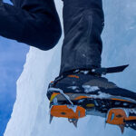
For hardgoods, you are looking for a good set of crampons to keep your traction, and an ice axe or two to arrest a fall and aid in climbing. The traditional mountaineering piolet, with a straight shaft and comfortable blade, allows for great support and self-arrest on the simpler routes. However, when the routes get steeper or the conditions turn icy, as they often do mid-winter, two curved* technical tools are often required (*slightly curved, don’t use this as an excuse to bring your new Ergonomics). Most brands offer an option in this class; with a slightly curved shaft, a hand resting pommel near the bottom, and a sharper blade for penetrating ice. Having two of these tools will keep you secure on the tougher sections. Crampons will help hold your feet on the mountain, and really most models will do for the routes on the South side. Whether it be the versatile “universal fit” with plastic stirrups, or the fancier “full-auto” to click on your boots akin to ski bindings, the important thing is sizing and fitting them correctly to your boots, so they don’t pop off mid-climb.
The Controversy?
Wait a minute? What about my fancy set of screws and 3-ft snow picket!?
Now, you may have noticed a distinct lack of some very important gear, ropes, and protection for belays. This gear could present some mild debate on certain Hood routes. If you are climbing something steep like the Elliot or Black Spider headwalls, you would certainly employ such gear. However, many of Hood’s easy to moderate routes often see parties forgo rope and protection in favor of moving fast through dangerous fall lines. My recommendation is to research the intended route, and perhaps talk with experienced climbers to discuss whether protection or speed are more important factors for safety. The one thing you should avoid is the all too common beginner practice of roping up on steep terrain such as the Pearly Gates, but not placing protection on their belay. A documented occurrence, climbers who rope up without placing protection can fall and drag their partners down, potentially “flossing” other parties below off the mountain with their now dangerous rope.
In steep terrain, you cannot rely on partner(s) to be able to self arrest, and if roped, protection must be placed. For easy to moderate routes, bringing a second tool instead of a rope and gear can often mean less weight and more efficient movement, which can help avoid falling debris or prevent a fall altogether.
The Bottom Line
Remember that climbing is all about adapting and learning to meet the challenge.
Hopefully this guide provides you with some information on climbing Wy’east and advancing your mountaineering journey. I couldn’t hope to include all the information needed for this sport, so I strongly urge you to further your mental toolbox by consulting as many other sources as you can. Get connected with local climbing groups on social media to find experienced partners and see conditions updates. Pacific Northwest Mountaineers is a great Facebook option, while The Mountain Shop partners with the local Portland Mountain Rescue team to offer lots of in-person classes and events. Consult other online sources and guidebooks to further your understanding of the peak and the routes that interest you. Consider an avalanche course as a necessity for staying alive in the mountains and furthering your climbing career on the snow. In the Portland area, Mountain Savvy is a great avalanche course provider staffed by local patrollers and rescue team members. And above all, find ways to safely collect experience in the mountains, as it is the best teacher out there.
*Note: Experiences in the mountains should always be safe, fun is optional.*
About the Gear Tester

Evan Watts
Evan grew up in the small hometown of Boring, Oregon, where he cut his teeth hiking and backpacking in the local Cascades. He now enjoys ice climbing, backcountry skiing, and trail running around in the Western States, and manages to fight off permanent employment despite an environmental engineering degree and perturbed parents.


Thanks for the straightforward post. I appreciate your information in regards to the basic gear needed and the verbal description of the various South side routes. Your referencing the belaying of roped climbing through the Gates is spot on, considering that historical event which pulled so many climbers into the Berg. Great job. You helped me visualize what to expect for my first potential summit coming up in two weeks (weather permitting).
Thanks Phoenix! Good luck on your trip!
Glad to help Pheonix! Looks like Hood has quite the snowpack this year, and there are some funky fumarole vents too! Portland Mountain Rescue has been posting updates on mountain conditions that are really helpful.
Cheers,
Hi Evan,
Thanks for this detailed description of the climb. I may be in the area over the summer (from Colorado, hah!) and am wondering how much approach can be done (presumably in a snowfield) prior to absolutely requiring gear. For example, I have climbed Rainier and of course on the most common approach the first 5000′ from Paradise to Camp Muir are over the (fairly tame) Muir snowfield. Anything like that there? I won’t be ready for anything technical (and probably aren’t in good enough shape anyway).
Thanks
Kendall
Hey Kendall,
The amount of approach that can be done without gear varies greatly on daytime temps, and how late into the summer you will be there. In late summer, you can hike about the first 4000′ without much issue, as gravel will be exposed most of the way up. Early summer would have frozen snow in the morning that would stop you around 2500′ up, and in the afternoon that snowy mush would be quite wet to hike in.
Why do you keep referring to “Wy’east” without explaining what “Wy’east” is? What is “Wy’east”? This is about Mt. Hood right?
Thanks for your comment! Wy’east is a common nickname for Mt. Hood. It is the name that the local Native Americans gave to the mountain. Hope that helps 🙂